
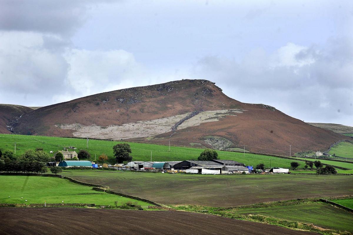
THIS short circular walk around the Embsay Moor Reservoir gives wide views over the surrounding fields and moorland edge, including Embsay Crag.
YORKSHIRE Water looks after 72,000 acres of land.
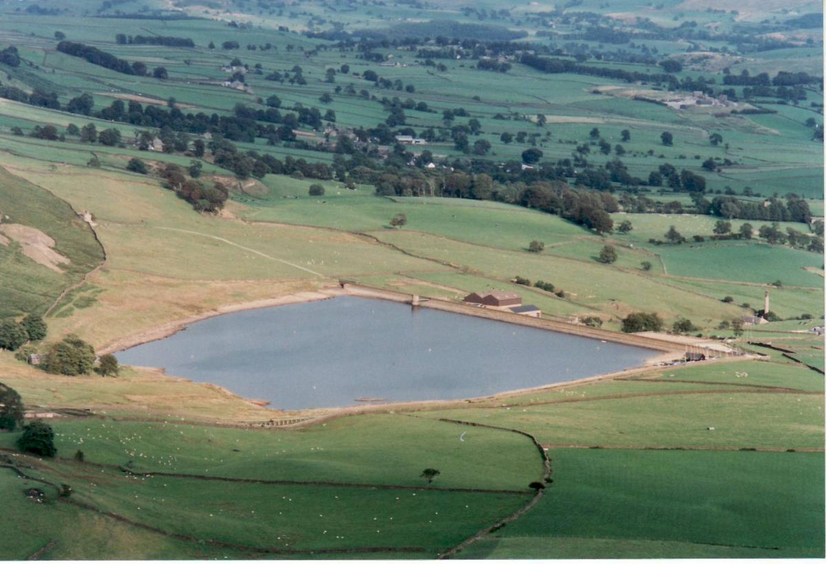
And among its assets is Embsay Reservoir - the location of this week's walk.
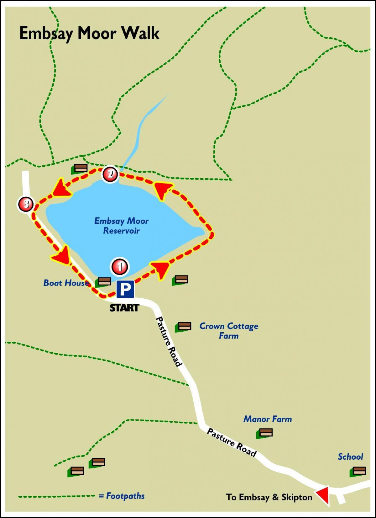
It starts in the reservoir car park, which is about a mile from the centre village and can be accessed via Pasture Road. However, the road is narrow, so care must be taken.
The reservoir was built at a cost of around £70,000 by Skipton Urban District Council to service the needs of a rapidly rising population in the area.
It took five years to build and was officially opened on June 21, 1910.
Today, the reservoir supplies water to 25,000 homes in the north and west of Skipton.
It is also used for leisure activities such as sailing, fishing, and walking, and is the home of the Craven Sailing Club.
The walk gives good views of the majestic Embsay Crag, which marks the start of Barden Moor, a large expanse of open moorland which is open access land and popular with walkers.
Embsay itself is worth a visit.
It is an attractive stone-built village on the very southern edge of the Yorkshire Dales National Park, the boundary of which runs along its main street.
The parish church stands on the original site of St Mary’s and St Cuthbert’s Abbey, an Augustinian priory founded around 1120 by William de Meschines, lord of Egremont, and his wife Cecily, daughter of Robert de Romille of Skipton Castle. The priory moved to Bolton Abbey in about 1154.
The village is also home of the Embsay and Bolton Abbey Steam Railway.
Run by volunteers, the heritage railway runs trains over part of the former Skipton-Ilkley line which was closed in 1965. Its ambition is to reopen the line from Skipton to Bolton Abbey.
For more walks on Yorkshire Water land, visit yorkshirewater.com/walks-and-leisure.
* Yorkshire Water has taken great care to ensure that the information is accurate. However, it accepts no liability for any claim, loss, damage or injury incurred by those using the information.
Step by step
1. From the car park, walk along the reservoir embankment to the stile on the left at the far end. Cross the stile and continue along the path keeping the dry stone wall on your right, over a stile in a fence to the footbridge.
2. Cross the footbridge and keeping the ruined building on the right, follow the path over a boardwalk across a wet section. Continue over some smaller footbridges to one of the stone stiles through the wall.
3. Cross over one of the stiles and turn left onto the unmade road, continuing past the boat house to the car park at point 1.
Fact file
Starting point: Embsay Reservoir car park
Distance: one to two miles
Difficulty: Mainly flat and on surfaced paths, however they can become muddy in wet weather.
Refreshments: Embsay
OS Map: Explorer OL2


Comments: Our rules
We want our comments to be a lively and valuable part of our community - a place where readers can debate and engage with the most important local issues. The ability to comment on our stories is a privilege, not a right, however, and that privilege may be withdrawn if it is abused or misused.
Please report any comments that break our rules.
Read the rules here