
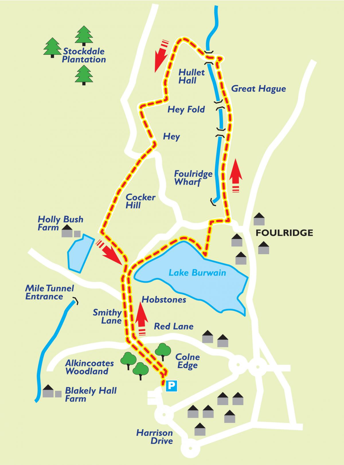
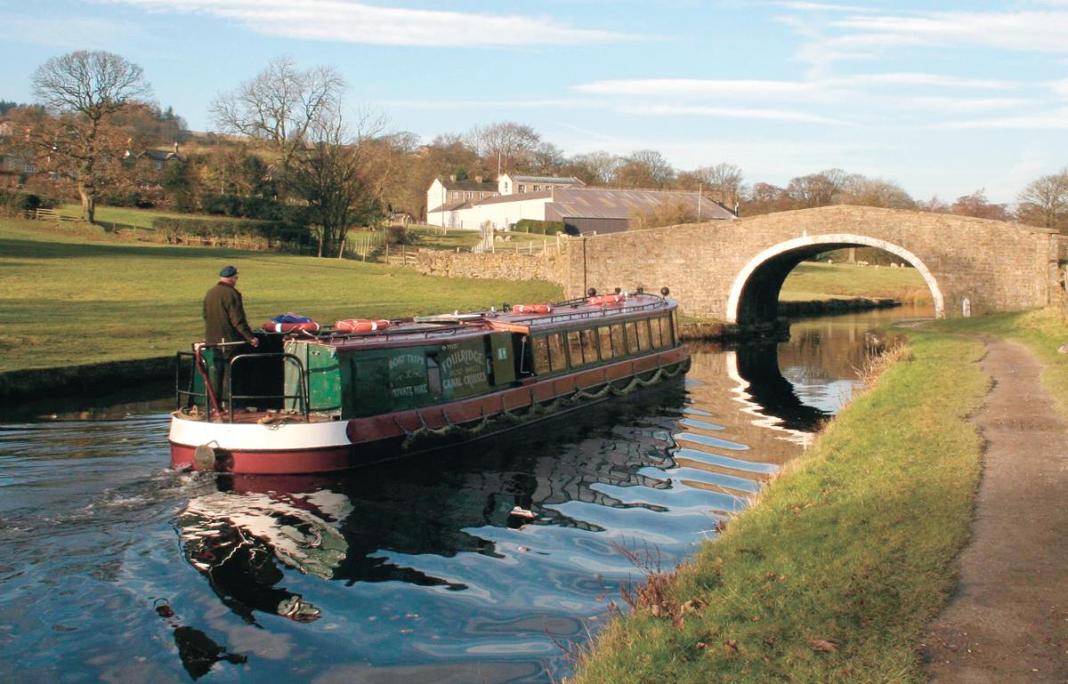
THE Leeds and Liverpool Canal - which celebrates its 200th anniversary next year - is a feature of this week's walk.
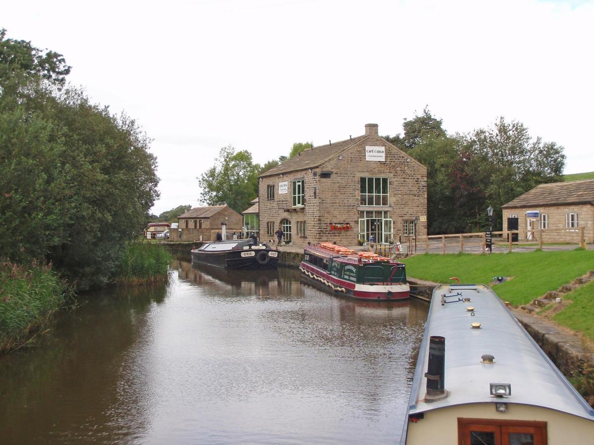
Covering five miles, it starts at Colne Rugby Club and points of interest include Foulridge Wharf, which was built in 1796.
Its warehouses were erected to 1815 to house the raw American cotton brought up via the canal for use in local miles.
And the canal boasts a mile-long tunnel, which is controlled by traffic lights.
Following the water theme, the walk also skirts Lake Burwain, home to a a wide variety of wildlife, including swans and kingfishers.
There is further interest on the last leg of the walk when the route passes County Brook Mill. This was a corn mill before the canal was built
and took its name and power from County Brook stream, which formed the boundary between Lancashire and Yorkshire prior to 1974. For many years the mill was known as ‘Stew Mill’ from stewing down oak bark for dyeing.
Many places in Colne have local names and the ancient Smithy Lane is no exception. It is also known as Blue Slate Lane and is best known to Colne folk as "Shirt Neck Harry". The Harry in question was Harry Rycroft, born in 1775, who as a young man became a navvy on the Leeds and Liverpool Canal. He walked up Smithy Lane every day from Blue Slate farm to buy provisions but being a working man wore neither collar or tie. As a local character he soon acquired the name of Shirt Neck Harry. The lane is still known as this even to this day.
The walk is one of several provided by Pendle Borough Council and for more options, logo onto visitpendle.com or call in at one of its tourist information centre.
Step by step
From the rugby club car park, walk directly across rugby field to access woodland. Follow the stone way markers to the exit onto Red Lane. Cross the
road and go down Smithy Lane, crossing the ford and continuing along the road until the entrance to Lake Burwain (also the entrance to the sailing club). Take the footpath going off to the left around the lake until you see a footpath sign for Foulridge Wharf.
Follow the signs for the wharf then continue along the towpath, cross the third bridge and go over the stile on the right. Walk up the hill, through two gates, seeing a large white building on the right (County Brook Mill). Walk up the lane until you reach Mount Pleasant Chapel on your left. Take the footpath by the side of the chapel until you arrive at the road at Hill Top.
Turn right up the road and take the stile on your left into a field. Follow the footpath across the field to a small gate and go straight across the two
driveways. Continue along the edge of the next field, keeping the stone wall on your left until you reach a stile that leads onto a stony path. Follow the stony path downhill to Sand Hall House. At the bottom, turn left and follow the track back towards Burwain sailing club crossing the old railway line.
At the end of the track (with sailing club in front) turn right. Cross the bridge at the ford and follow Smithy Lane back up the hill to Alkincoates Woodland.


Comments: Our rules
We want our comments to be a lively and valuable part of our community - a place where readers can debate and engage with the most important local issues. The ability to comment on our stories is a privilege, not a right, however, and that privilege may be withdrawn if it is abused or misused.
Please report any comments that break our rules.
Read the rules here