
I DO enjoy a walk in Lancashire. The countryside is quite different, not so dramatic as the Dales perhaps, but beautifully lush, and not anywhere near as busy.
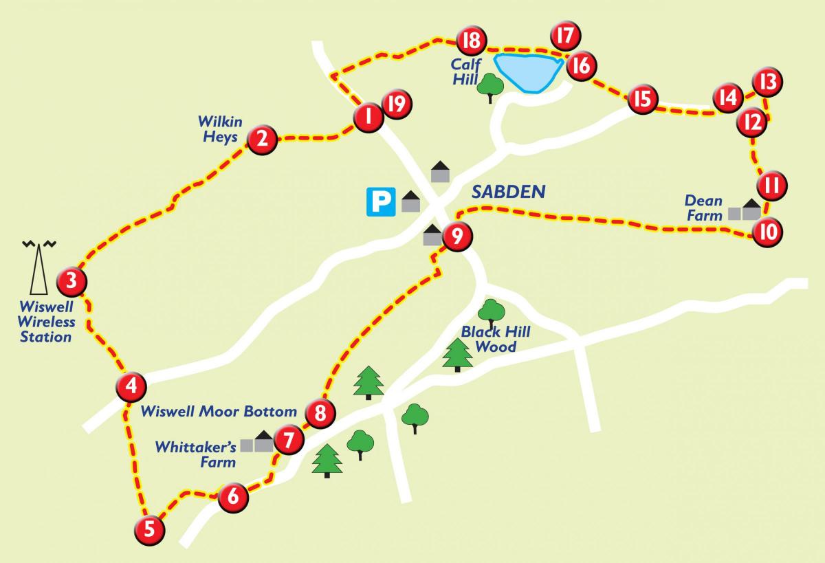
This circular walk from Sabden is long enough, almost ten miles, but very gentle, there is hardly any climbing to do.
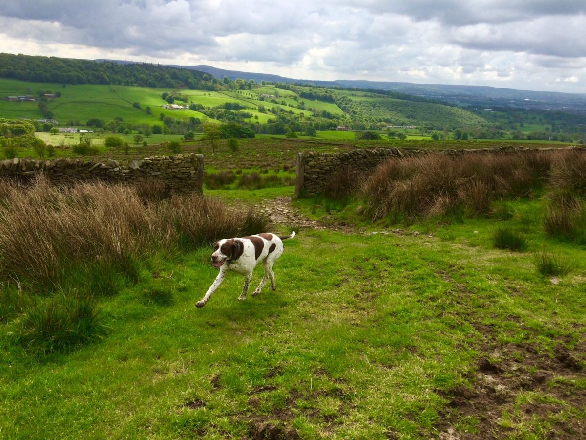
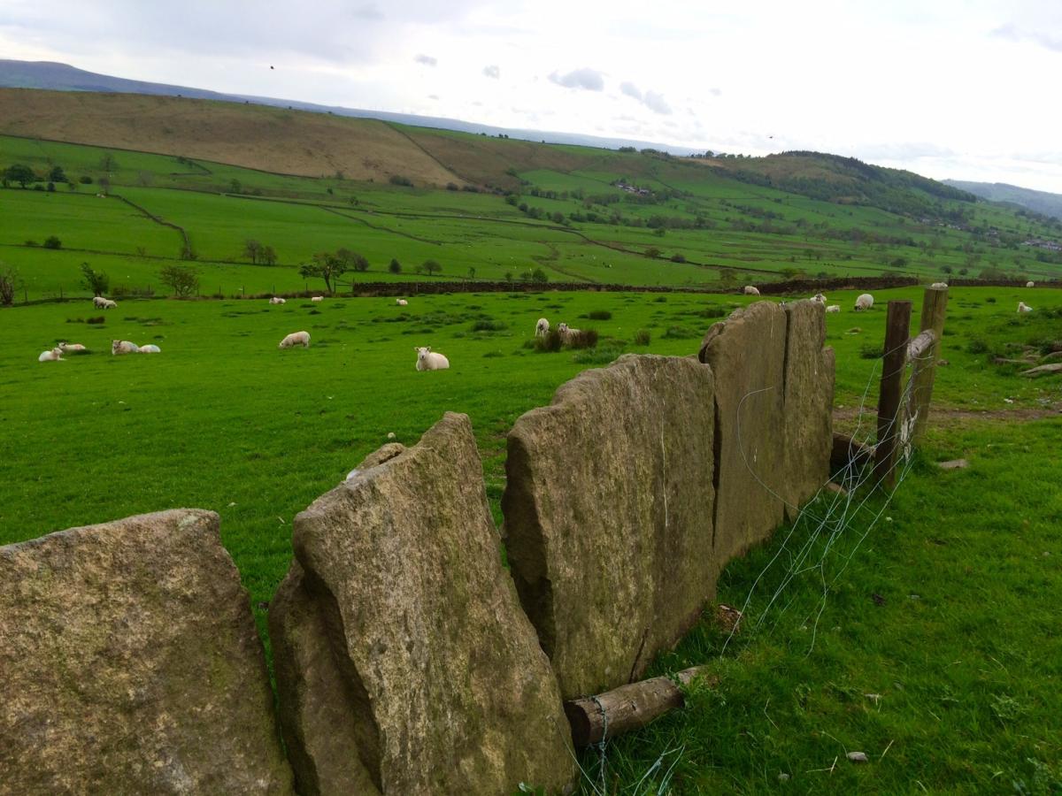
The route passes alongside an ancient vaccary wall, believed to be the oldest in the valley, and offers some stunning views.
Interestingly, at several points on the walk, it is possible - if you have that sort of vehicle - to see your car where you've left it at the top of the hill coming into Sabden. If you've got a dog with you, you might find some of the stiles a bit awkward, and as always, do make sure they are kept under control and pick up after them.
Step by step
1. From the layby, cross over road and follow the way marker, go through a gate and cross field, heading for a gap in wall. Then, following yellow footpath signs, head downhill, over a beck and then to the right of the farmhouse. The footpath is not that obvious, but as long as you head to the right of the farmhouse, you'll find the stile.
2. Go over the stile, and climb straight up to the track - a bridlepath - and turn left. Continue along the bridlepath, passing the farm on the left, and continue through two gates.
3. Just before the third gate and in front of the farmhouse, turn left, keeping closely to the wall on right and follow the path downhill. Just after the wall goes sharply off to the right, continue straight ahead and pass through a belt of trees and go downhill, heading towards some buildings. To the right of the buildings are two stiles, take the one on the right. Go over the stile and over a small stream and over field to next stile in fence, then straight ahead to ladder stile on to road. Turn right.
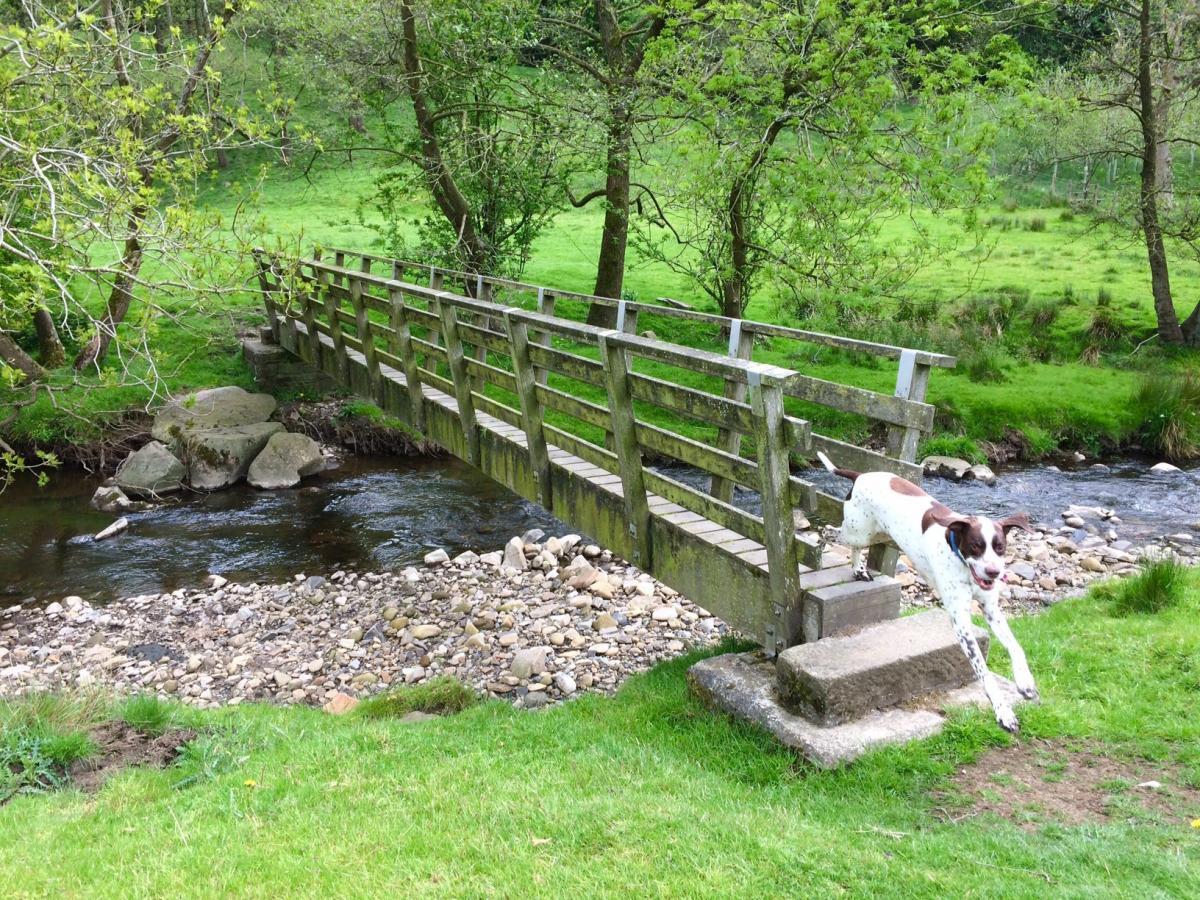
4. After a short way, take the metal stile on the left into a field. Follow the left hand boundary of the field closely until it goes off sharply to the left. At this point, head in a straight line down to Sabden brook. Cross over the stile and head for the wooden footbridge. Go over the bridge and then go right and over stile into at first new planting and then into an older wood. Path goes quite steeply uphill and can be quite muddy underfoot. The path does a fair bit of winding, but is easy enough to follow. As the wood thins out, the path becomes narrow and overgrown and after a short while, comes out at a farm with stables.
5. Turn left here, following the footpath signs and head for two metal gates. Take the footpath through the right hand gate which goes across a horse exercise arena. Head to the top left hand corner , go over the stile and stick to the obvious path as it climbs gently uphill through the lovely wildflower meadow, which was thoughtfully mown when I was there to show you the way. The path passes closely to a wind turbine on the right hand side. Continue on the path and head for the right corner of the field. There are lovely views over to the left here. Go over two stiles and onto a narrow, quiet road.
6. Turn left on the road and after about a quarter of a mile, take the track, marked footpath, on the left. There is a cattle grid, with a gate on the left.
7. Follow the track as it goes gently downhill towards a house and wind turbine on left. Where the track goes off to left to the house, take the right grass path and go over a stile and into a field, with woodland on your right. At this point, if you have a distinctive, or high sided vehicle, you will be able to spot in in the distance at the layby just outside Sabden.
8. Follow the path as is goes diagonally across the field to the corner towards the left. Continue along the obvious track for some way. Eventually, you will come to houses, a path from Sabden will come up from left. Continue along the path, which will go off to the left and then out onto a residential road. Take the third road off to the left, which is actually marked bridlepath. At the end of the short road, passing several houses on both sides, go left over the bridge and straight over the road, passing Stubbins Vale holiday homes on right.
10. Continue uphill along the road, passing sheltered housing on the right. Just before the junction of St Nicholas Avenue and Stubbins lane, turn right, taking the bridlepath marked to Dean Farm. When you reach the farm, take the left fork passing it and before you go into the farmyard, go through a gate on right, and immediately over a stone stile.
11. Climb uphill through the field, following the path, to the stile in the left hand corner of the field. Keep ahead to the next stile, and follow the path as it passes to the side of a house. At the end of the boundary of the house, go through the gate, along the driveway and then turn right onto the surfaced track - marked bridlepath.
12. Follow the path as it drops down, through a gate and over a stream, with some old farm buildings on right. Don't get too distracted by farm buildings - as I did - and miss the stile into woodland on the left hand side. If you miss the stile, you'll end up on the old track for some way.
13. Follow the stream in the lovely little wood as it winds its way through trees, and then leave the stream as the path breaks off to right to stile - a steep and possibly muddy climb.
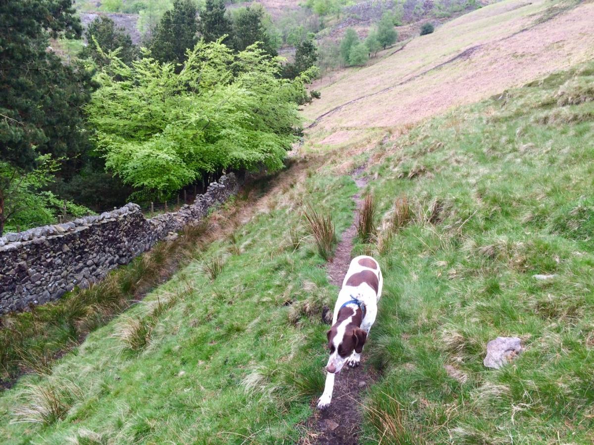
14. Go over stile into the field, and after a short way, bear left, downhill to the stream, cross over it and then over stile. Go left and pass through some new planting, uphill, over stile and right towards Stainscombe Farm.With the farm on your right, take the higher road with the wall on your left. Here, you will see the vaccary wall, believed to be the oldest in the valley and originally used to fence in cattle. Continue along the track for some way and just before Ratten Clough Farm, go through the gate to the right of entrance. Follow the path, passing stables on left, and keeping to left, cross over stile in the wall in the corner of field. Follow path uphill towards the pine wood, you will be able to see the reservoir below to your left. Follow the path as it goes to the right of the wood and steeply downhill.
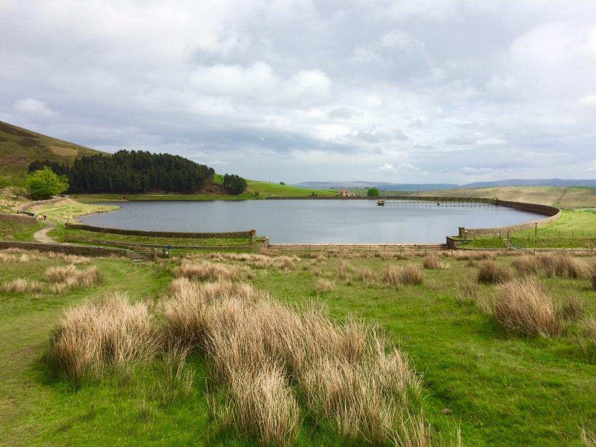
15. At the bottom of the hill and after the end of the wood, turn sharp left and head down towards the reservoir, go through an iron gate and turn right along the edge of reservoir.Go through one gate and keeping to path, leave reservoir on the left and climb uphill, passing through two more gates.
16. After a while, you will come to a finger post. Take the path towards Clitheroe Road. At the road, there is a useful track running parallel to it which will return you back to your car.
Fact file
Start/finish: Sabden
Distance: Nine miles, allow at least four hours
Difficulty level: Easy
Terrain: Fields, tracks, quiet roads, some walking through centre of Sabden.
Livestock: Plenty of sheep and cattle about, dogs must be kept under close control.
Stiles/gates: There are some difficult stiles on this walk which will present problems for some less nimble dogs to get over.
Refreshments: Sabden
Parking: A large and free surfaced layby on the left hand side of Clitheroe Road, just before you drop down into Sabden.
OS Map: OS Explorer OL21


Comments: Our rules
We want our comments to be a lively and valuable part of our community - a place where readers can debate and engage with the most important local issues. The ability to comment on our stories is a privilege, not a right, however, and that privilege may be withdrawn if it is abused or misused.
Please report any comments that break our rules.
Read the rules here