
STAINFORTH was given its name by the Anglo-Saxons.
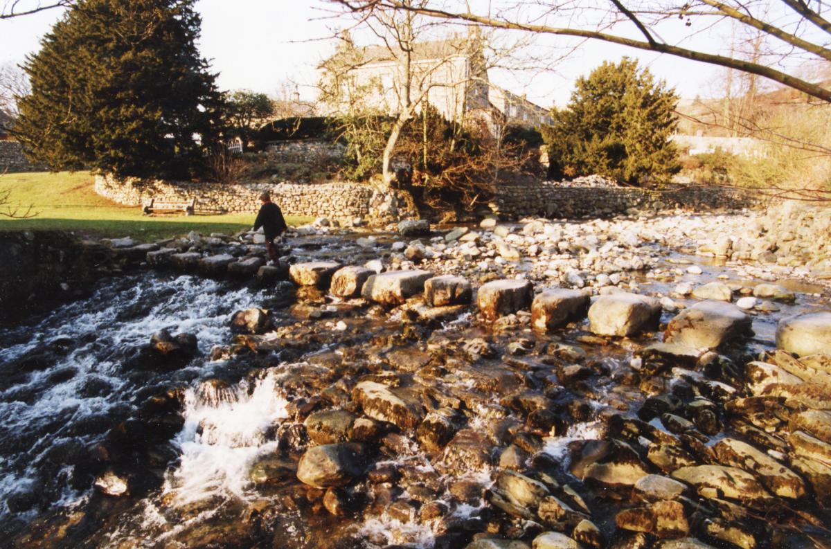
It means "stony ford" which refers to the ford by the stepping stones across Stainforth Beck - which is where our walk ends.
The beck runs through the centre of the village, which was once a farming community belonging to Sawley Abbey before becoming a hive of industry with two water-powered cotton mills, a linen works, leather and paper making, and brewing.
Today it has about 200 electors and its attractions include two waterfalls - Catrigg Force and Stainforth Force.
The latter was said to be a favourite spot of composer Sir Edgar Elgar and, in autumn, salmon can often be found leaping there.
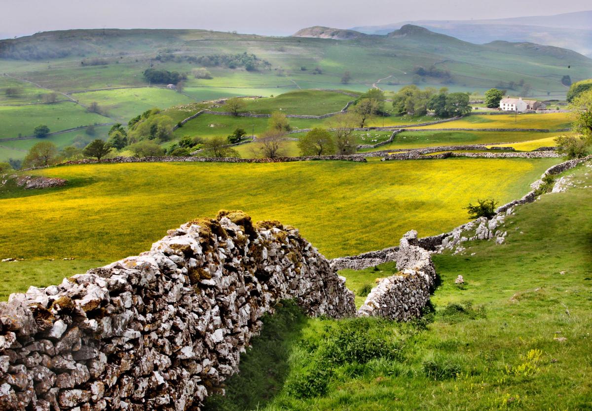
The walk visits Lower Winskill, which is set in spectacular limestone scenery overlooking Ribblesdale. The working farm uses methods that encourage wildlife and protect the historic landscape.
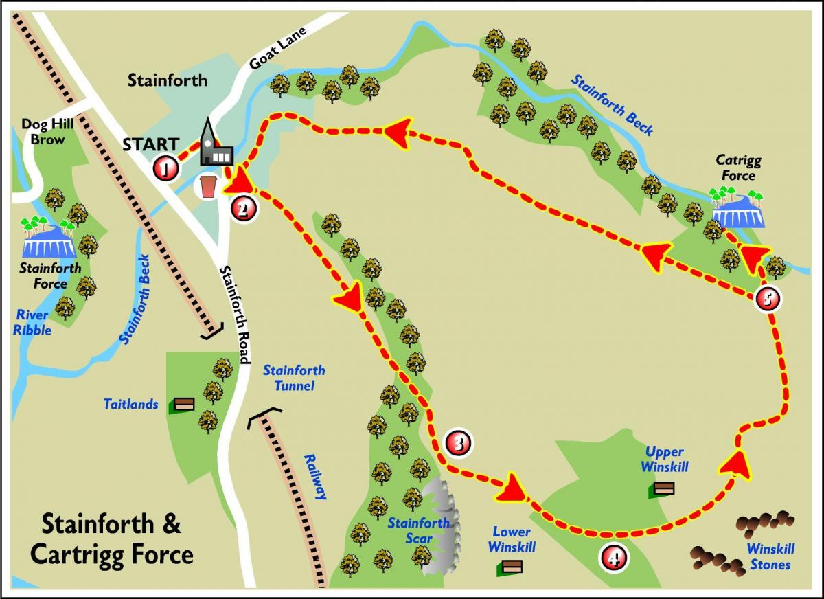
Devised by the Yorkshire Dales National Park Authority, the route includes number of stiles and a steep climb and the footpath
through Stainforth Scar wood can be slippery.
Walkers are urged to follow the Countryside Code.This includes respecting other people (leave gates as you find them and follow paths), protecting the environment (take litter home and keep dogs under control) and enjoying the outdoors (plan ahead and follow local signs).
More walks in the national park can be found at yorkshiredales.org.uk.
Step by step
1. Leave the car park from the main entrance and turn right. Follow the road, over the 14th century bridge to reach the pub on your right hand side.
2. Take the narrow road to the left, signposted PBW. Bear right and then take the footpath off to the left in between the cottages, follow through open fields to the woodland. The path climbs up a limestone stairway through the woods above Stainforth Scar.
3. Emerging at the top of the climb, fine views up Ribblesdale can be enjoyed. After leaving the woods take the left hand path through to Upper Winskill Farm.
4. Go through the farmyard and follow the driveway. Where the main gravel track turns right carry straight ahead next to a wall, following the bridleway signposted Stainforth 1¾. Continue down through a gate signposted Pennine Bridleway Stainforth, where you will see fine panoramic views of the Yorkshire Dales Three Peaks - Penyghent to the near right, Ingleborough to the left and Whernside to the far right. The track leads you to the top of Goatscar Lane, this historic lane was once part of a vital trade link between Ripon and Lancaster.
5. Go through the gate onto the lane and on the right is a path leading down to Catrigg Force waterfall – take care down the slope and near the edge. Retrace your steps to the lane, follow it down to return to Stainforth village green. Either follow the road round to the left, back to the bridge and car park, or continue ahead crossing Stainforth Beck via the stepping stones and follow the road back to the car park.
Fact file
Distance: Three kilometres (two miles).
Time: a minimum of one hour.
Going: moderate, with a steep climb.
Parking: Stainforth car park.
Toilets: Stainforth car park.
Refreshments: pub in Stainforth Village. There are also many cafes, shops and pubs in Settle Town, approximately two miles away.


Comments: Our rules
We want our comments to be a lively and valuable part of our community - a place where readers can debate and engage with the most important local issues. The ability to comment on our stories is a privilege, not a right, however, and that privilege may be withdrawn if it is abused or misused.
Please report any comments that break our rules.
Read the rules here