
CLIVE White ventures out to explore some of the route taken by Lady Anne Clifford and her household crew more than 350 years ago when commuting between Skipton Castle and Brougham Castle near Penrith. Today it is an official long distance path of about 100 miles.
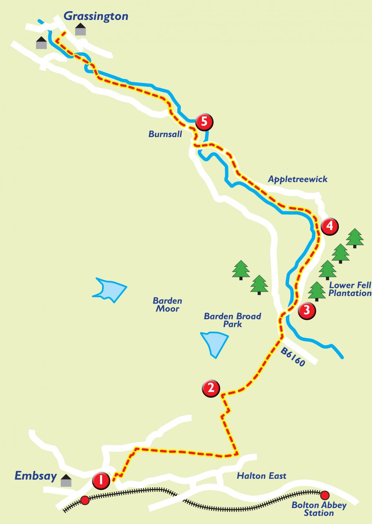
THIS walk takes in part of Lady Anne's Way, covering about 12 miles from Embsay to Grassington, much of it a panoramic, low level trek along the bank of the river Wharfe.
Lady Anne and her cohort would have kicked off from Skipton Castle, turned right and trudged up Chapel Hill, keeping left and continuing up and over the brow, across what today is Skipton bypass, forward and through the landscape which is now Skipton golf course before eventually turning right and pushing on to enter Embsay. She would have taken the low road, so to speak, along Moor Lane and Bolton Abbey.
We on the other hand ventured out from Embsay car park on one of those rare springtime mornings, still and bright, which act like a shot of adrenalin.
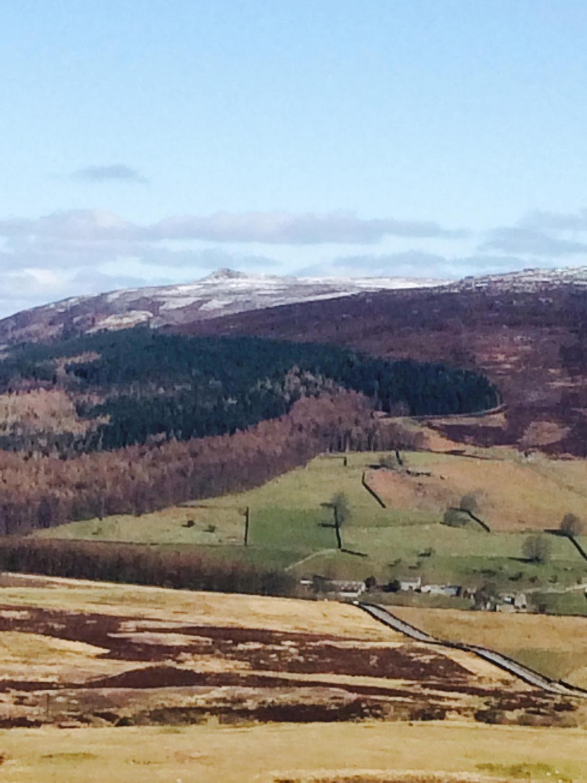
Ahead is the steepest part of the route which sweeps up hill, a fairly hard calf-straining jaunt, to the summit and a spectacular view down into Wharfedale and Barden Tower with snow capped distant fells and Barden Fell to the left.
Once down in the valley and across Barden Bridge the hard work is over, for the route now follows the Dales Way through Howgill, passing Appletreewick, into Burnsall and eventually Grassington.
Step by step
1. Take the stile at the rear-right of Embsay car park which eventually leads diagonally across a field to another stile at the far side. Keep Embsay Church in view. Once through, bear right across the road to another fingerpost directed onto a "trod" across the site of the original Augustinian monastery before it shifted to Bolton Abbey in the 12th century. Leave the path at Eastby, turn right passing the ancient village jail, still barred, and on to where it curves sharply uphill on the left. Ignore this and go straight along Bark Lane towards Halton Gill. This takes you through three fields in the direction of Billy Bob's ice cream parlour at Calm Slate Farm. Go through into the car park, turning right and walking along a concrete road to the main road and turning left towards Halton East. Walk uphill, bearing left and swinging towards Halton Church Mission Room. Here there is the alternative of pushing on a quarter of a mile, which Lady Anne is likely to have used, and taking the moorland footpath to Halton Edge or alternatively, as we did, take the track on the left which leads steeply in parts but easy under foot to emerge near to the cattle grid looking down towards Barden.
2. From there it is a road walk down to Barden, passing as we did a group of men with powerful telescopes spying birds of prey. Turn left, passing the tower itself, swinging right down to the bridge and joining the Dales Way footpath which takes the bank of the river Wharfe. This is a wonderful, level stroll along the valley bottom, curtained by the fells and on this day when looking back, a spectacular view of snow-capped Simon's Seat. Keeping going for about a mile, passing through an enclave which is home to two timber holiday homes looking over the river. The path becomes a track through some farm buildings until reaching Howgill Beck, where it enters the road.
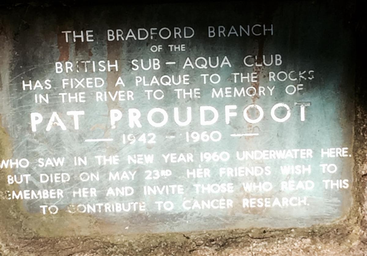
3. On the left is a signpost to Appletreewick and Burnsall and the path returns to the river. Nearby is a memorial to Pat Proudfoot, a member of the Bradford branch of the sub-aqua club, who saw in the New Year 1960 at the spot but died on May 23 - she was just 18. People are invited to contribute to cancer research. This is an idyllic part of the river as it winds through woodland - leafless at this time - and passes rapids popular with canoeists.
4. The route from here to Burnsall is easy and hugs the river bank, passing Appletreewick, viewed across a field on the right. After going through Woodhouse Farm, a slight detour to the right takes you another stile back on the riverside and on through fields to Burnsall.
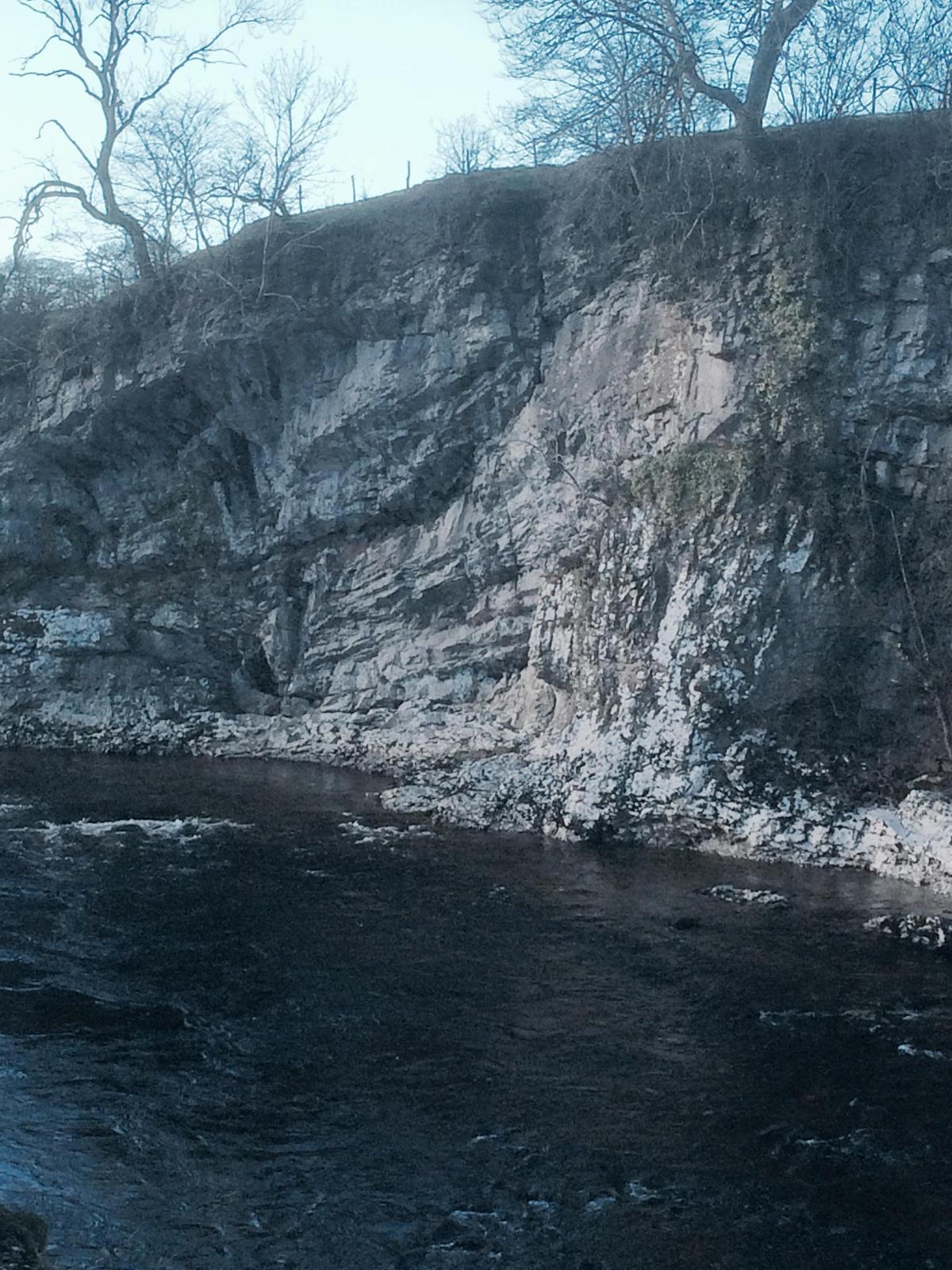
5. Try a quiet rest on the benches over looking the river. Cross the road and sneak down passed the Red Lion to join the river path again. This is another wonderful walk passing through a steep-sided limestone gorge. From here it is plain sailing on into Grassington with Linton Church and Linton Falls on the left. Back in Grassington, we caught the late evening bus back to Skipton.
FACT FILE
Location: Yorkshire Dales National Park
Start Embsay, finish Grassington.
Distance: About 12 miles. About five hours.
Refreshments: Barden, Burnsall, Grassington.
OS map: OL2


Comments: Our rules
We want our comments to be a lively and valuable part of our community - a place where readers can debate and engage with the most important local issues. The ability to comment on our stories is a privilege, not a right, however, and that privilege may be withdrawn if it is abused or misused.
Please report any comments that break our rules.
Read the rules here