

NEW research into the flood risks faced by Silsden residents has been welcomed by local councillor Adrian Naylor.
He said the Environment Agency study, due to be published in March, could help ensure future housing developments did not place further pressure on Silsden Beck.
And he warned it was essential that Bradford Council planners told housing companies to use the new data when devising flood strategies for potential Silsden developments.
Cllr Naylor, who sits on both Bradford and Silsden councils, has repeatedly warned that Silsden’s huge house building programme – 1,200 have been earmarked for the town over the next few years – could worsen existing flood risks.
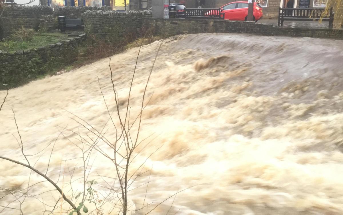
The Boxing Day floods of 2015 caused the beck to overflow, becoming blocked with debris near Belton Road and extensively damaging a wall fronting onto Keighley Road.
Cllr Naylor pointed out that since 2015 hundreds more houses have either been built, or are in the planning stages, on land upstream of the beck’s Belton Road bottleneck. These include more than 200 on the Barratt development off Belton Road itself.
Cllr Naylor said: “More flooding like what happened on Boxing Day is likely, given issues like climate change. Last time we had maybe 100 houses that were potentially cut off for vehicle access. Now, due to the building of more houses, we would have 300 and 400 houses cut off.”
The Environment Agency research will update the existing Silsden Main River Model and Surface Water Model, and will update Bradford Council’s 2016 assessment of the flood risks posed in Silsden.
The 2016 report – commissioned in the wake of the 2015 floods – presented various options for tackling Silsden’s flood risks, balancing the costs against the benefits.
Cllr Naylor said: “We know we have a problem at Belton Road because of the bottleneck and we need to overcome that. We know there’s also going to be a housing application for the nearby Riverside Works site. Water only has the beck to flow out of, so putting more water into the beck isn’t a good idea.”
The Environment Agency this week confirmed its latest work was to produce new models to further its understanding of the flood risk in the Silsden area.
A spokesman said: “The work involves analysing existing rainwater data, computer flood modelling and simulations, and mapping of flood routes and flood depths across the land.”
Cllr Naylor said: “I welcome any updates to the modelling. We need more accurate, up-to-date and realistic information for when rainwater is likely to be become a flooding issue.”
Cllr Naylor said it was essential that council planners told housing companies to use the new data when devising flood strategies for potential Silsden developments, to avoid putting further strain on Silsden Beck.


Comments: Our rules
We want our comments to be a lively and valuable part of our community - a place where readers can debate and engage with the most important local issues. The ability to comment on our stories is a privilege, not a right, however, and that privilege may be withdrawn if it is abused or misused.
Please report any comments that break our rules.
Read the rules hereLast Updated:
Report this comment Cancel