

Jonathan Smith runs Where2walk, a walking company in the Yorkshire Dales.
Jonathan has written his own book, the Dales 30 which details the highest mountains in the Dales.
He also runs one-day navigation courses for beginners and intermediates. Join his Learn a Skill, Climb a Hill weekends in the Dales.
To find out more details on any of the above visit his website, where2walk.co.uk
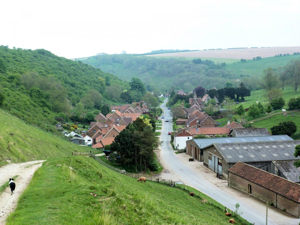
THIXENDALE is a little gem, tucked deep in one of the impressive chalk valleys which so characterise this part of the Yorkshire Wolds.
The walk itself tends to stick to the higher chalk scarps rather than the valley floors except where it drops to the medieval, deserted village of Wharram Percy.
Thixendale is a delightful village, tucked between a variety of intersecting chalk valleys. It was infamous a while ago for its inability to get a satellite signal but now is supplied and amongst its highlights are the lovely St Mary’s Church and an excellent pub, the Cross Keys.
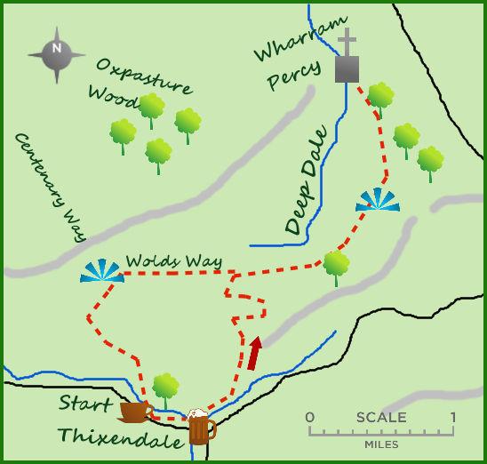
Park in the centre of the village and head north east on the path opposite the pub.
This is Water Dale but after 400m the path bends north in to a second steep sided dale, Court Dale.
A steep climb takes you away from the valley floor to its eastern rim. Here the views down dale and across the countryside so typify the chalk landscape of the Yorkshire Wolds.
The most intriguing aspect of the valleys is they are almost inevitably dry, despite the steep slopes. The valleys themselves were created at the end of the last ice age, 15,000 years ago, with fast running water creating deep valleys on the frozen ground. However being on a chalk bedrock means the normal streams drain away leaving a unique and almost uniformerly dry landscape. Unusual!
The path follows the crest of the valley north for 500 m then cuts east and steadily uphill for 300m before joining a farm track and continuing north till it meets the Yorkshire Wolds Way.
Head east until meeting some woodland. The path carries alongside the woods overlooking another deep dale, conveniently called Deep Dale.
Where the path divides take the left fork. Heading north the church at Wharram Percy appears in the distance.
The Wolds Way drops towards the church and in to the deep valley. Wharram Percy is an exceptionally interesting and well researched ruined medieval village. There has been much excavation undertaken concerning the village which thrived between the 9th and 15th century. The church has survived better than anything but the remains of houses and other building can be seen and are worth an explore.
Return via the same route to the head of Deep Dale but to vary the end of the walk carry on westwards past a small set of woodland on your left for three quarters of a mile.
The deep valley to your right has become much shallower. At a junction of paths follow the Yorkshire Wolds Way south as it drops and climbs steeply out of Valley Pasture Dale.
From here the path turns in to wider track.
The track soon emerges, past some earth workings on your left at the head of the valley with Thixendale at its foot.
The track down creates one of the most picture perfect scene in Yorkshire.
Fact File:
Distance: Roughly seven miles.
Height to Climb: 190m (610 feet)
Start: SE 845611. Park conveniently in the village, best near the pub. .
Difficulty: Medium. The climbs and descents are all steep but the routeis very uniform.
Refreshments: The Cross Keys in Thixendale is excellent.
Be Prepared: The route description and sketch map only provide a guide to the walk. You must take out and be able to read a map (O/S Explorer 294) and in cloudy/misty conditions a compass. You must also wear the correct clothing and footwear for the outdoors. Whilst every effort is made to provide accurate information, walkers head out at their own risk.


Comments: Our rules
We want our comments to be a lively and valuable part of our community - a place where readers can debate and engage with the most important local issues. The ability to comment on our stories is a privilege, not a right, however, and that privilege may be withdrawn if it is abused or misused.
Please report any comments that break our rules.
Read the rules hereComments are closed on this article