

IT was only when I arrived on the outskirts of Settle along the Ribble Way that I realised I was heading the wrong way.
I’m no map reader, I generally leave that to my husband, he enjoys it, loves maps, so that’s his job. On this occasion, he dropped me off and I was on my own, heading back home; optimistically, using the Ribble Way. Sadly, I have an appalling sense of direction, and so ended up heading in entirely the wrong direction for some five or six miles.
Something clearly needed to be done, seeing as I can’t rely on any directional sense, and as any walker who ventures off the areas most popular paths knows - five miles radius of Malham or Grassington for example - footpath signs can’t always be relied upon.
Step forward mountain leader, Joanne Wulf, of Wolftracks. Joanne, who is also a language teacher, offered to give me an introduction to navigation skills, so armed with a map, I headed off to Settle to meet her.
I will add at this point, it was in between coronavirus lock downs one and two, and we took the necessary precautions, kept our distance and used anti- bacterial hand wash after passing through gates and stiles.
Joanne started off by showing me some beautiful maps, in my ignorance I’d only really looked in any detail at Ordnance Survey maps, and was fascinated at some Joanne brought along, such lovely colours, no wonder people have them mounted and put on walls.
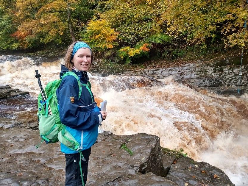
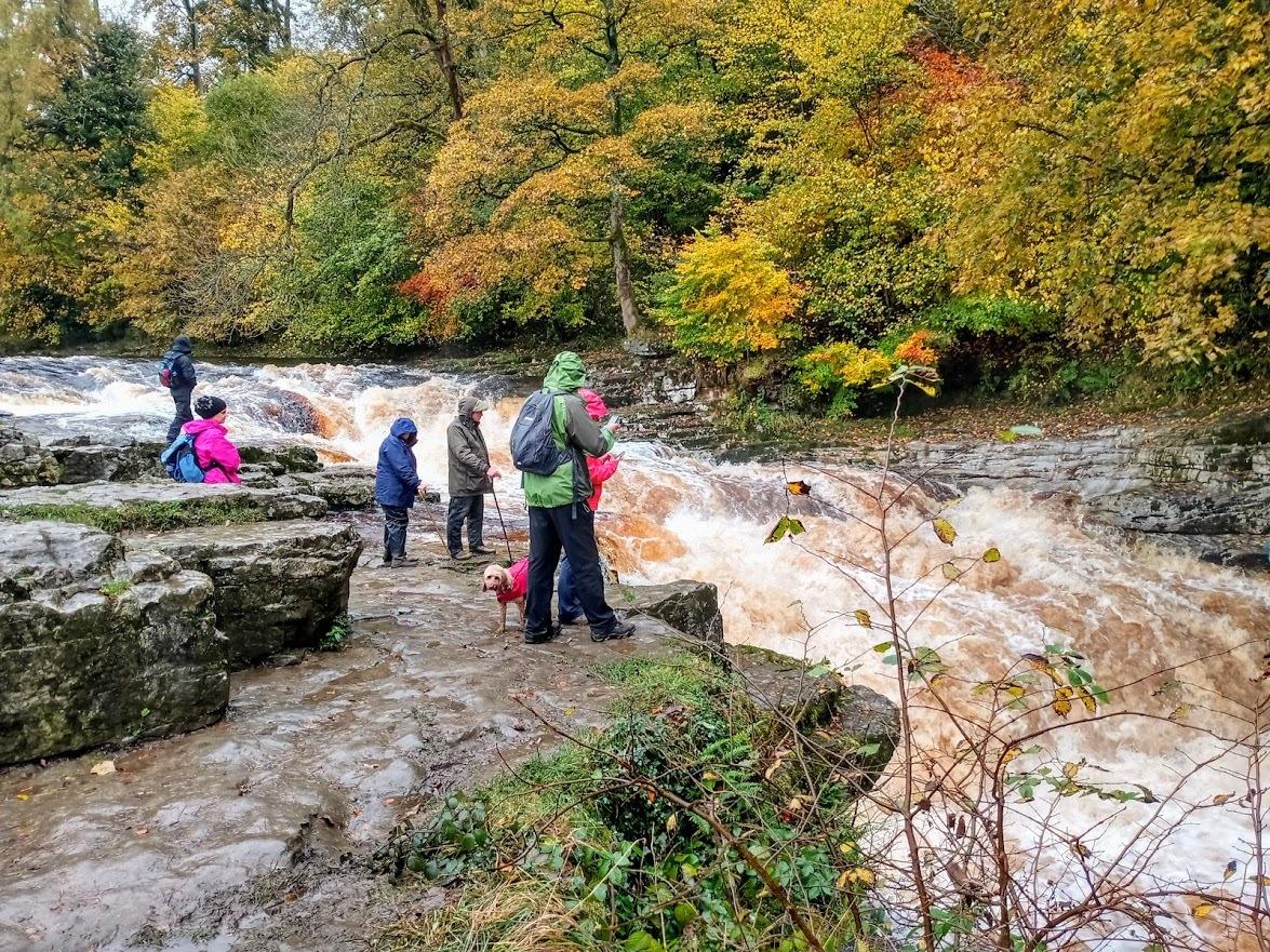
After a few basics, we headed off towards Stainforth Foss in the search of salmon.
Now, this is a well known area for me, but with Joanne beside me pointing landmarks out on the map, I was seeing things for the first time.
Joanne says she has always had a passion for the outdoors, stemming back from a childhood growing up in the Lake District, where she has fond memories of family walks and looking out for her next adventure.
Her family moved to South Africa, and after 26 years, she moved back and settled in the Yorkshire Dales.
“We have tourists all year round visiting the area and there are lots of popular attractions from Ribblehead to Malham Cove but these beauty spots can be visited from a different angle.
“I always try to show people something a little bit different, off the beaten track or quieter. Some customers simply want to achieve one of our famous three peaks, but lack the confidence or skills to do it on their own,” she says.
“I think the best way to learn is to practise in as many environments and situations as possible. The Yorkshire Dales has a good mixture of terrain – streams, rivers, valley bottoms, rights of way through farmland or open access land, dry stone walls to navigate by, or for the more advanced, open moorland and peaks higher up.”
Joanne is a qualified summer mountain leader and rock climbing instructor and is also a fell rescue volunteer. “I just love sharing what I do and seeing clients pick it up. Whatever level you are at, there is always more to learn, you just need to keep practising and plan a route somewhere new. It’s a great skill for the whole family to learn, the younger the better.”
Joanne takes out all sorts of people on map reading sessions, so carefully tailors sessions to suit levels of fitness, and ability.
“An advanced map reading session would involve being higher up in the hills, off the path, learning how to walk 100m as accurately as possible by counting your steps, using a compass to walk on a bearing, techniques for navigating in poor visibility - fog is a common occurrence on the summit of Ingleborough- and how to relocate if you were to get lost,” she says.
Meanwhile, a typical novice session can last a half day.
“I recently took two beginners out, who by the end of five hours could recognise basic features and different rights of way on an Ordnance Survey Explorer map, measure each leg that we were about to walk and work out how long it would take us to do it.
“This is crucial for planning a walk safely, knowing how fast you move and how far you can manage.
“All too often walkers around here have run out of steam or it has become dark and that’s when you’re in danger of falling and injuring yourself.
“Being on the hill in that situation without the correct equipment- things like a torch, clothing, food and water can turn out to be very dangerous.
“First and foremost, I teach novices how to stay safe in the hills and avoid getting themselves into situations where they might need rescuing.
“It’s surprising how many folk aren’t aware how to call for help if they need help from their local mountain rescue team, and many good map readers have never learnt how to give their location using a grid reference using ‘old school’ map skills.”
Joanne says she is definitely ‘old school’.
“I admire my tech-savvy friends but although I am wary of navigation technology, I have to work with it sometimes. I just find using a paper map far more satisfying, empowering even.
“It’s a much better way to get a fuller picture of where you are and where you are heading.”
To find out more about Joanne’s map reading sessions, visit: www.wolftracks.co.uk


Comments: Our rules
We want our comments to be a lively and valuable part of our community - a place where readers can debate and engage with the most important local issues. The ability to comment on our stories is a privilege, not a right, however, and that privilege may be withdrawn if it is abused or misused.
Please report any comments that break our rules.
Read the rules here