

FARMERS have helped to produce a new interactive map showing the location of important habitats in the Dales national park – and are encouraging fellow land managers to use it to spot opportunities for new income streams and conservation work.
‘Re:Cover’ is designed to help people looking to protect, expand and connect habitats such as flower-rich hay meadows, wildlife-rich wetlands and ancient woodlands, says the national park authority.
It uses information gathered from surveys carried out every year since 2010 as well as information collected by Natural England and the Forestry Commission, and has been developed in partnership with the Yorkshire Dales Farming and Land Management Forum.
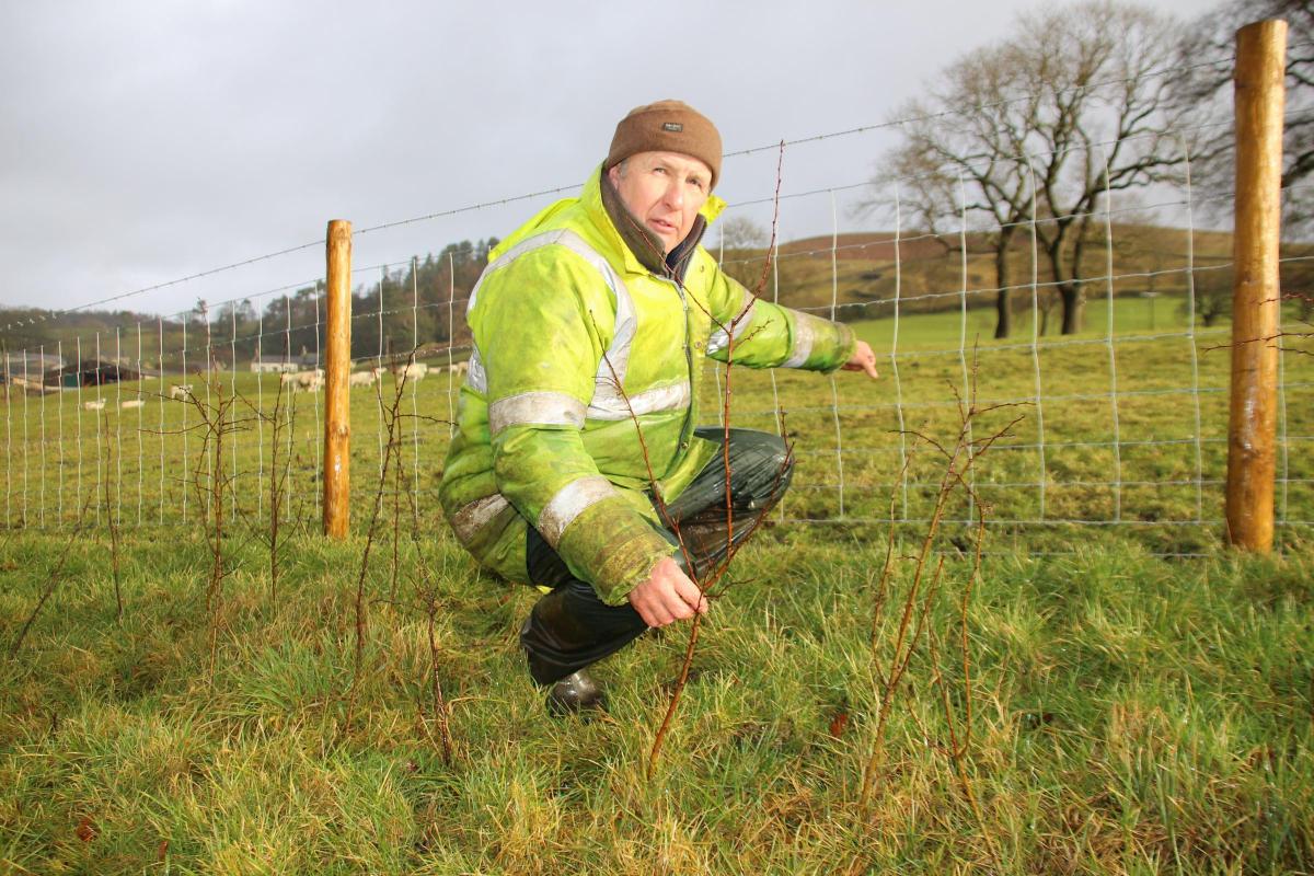
Forum member, Anthony Bradley, who farms at Mearbeck, between Settle and Long Preston, tested the map as it was being developed and has already seen evidence of wildlife, such as dragonflies and long-tailed tits.
“The Farming and Land Management Forum and the steering group for the National Park Management Plan were keen to have this habitat map,” he said.
“The great thing about it is that it shows you what you’ve got and the possibilities that can come from that. It’s a really good starting point if you’re thinking of doing some stewardship scheme or other work like that, giving a factual basis for informed discussion.”
Mr Bradley, who runs150 ewes and about the same number of rearing cattle on 90 acres, has been planting hedges as part of a countryside stewardship agreement.
He said: “We had these little bits of beckside woods and some old ancient hedges that were all fragmented. Even on our modest-sized place we’ve managed to put in , 1,300 metres of hedge to try to connect it all. And we’ll go for another five or six hundred metres if we can get the funding. “
He added: “I saw a dragonfly here by Mearbeck last summer. I haven’t seen a dragonfly on this beck since I don’t know when.
“There’s an old hedge that we’ve connected to and, well, there was an enormous flock of long tailed tits in there. If people know where there are hedges and woods and all the rest of it, you can start to see where you can make links. Farmers want to farm. But we get that we have to do this other stuff, too. There are many win-wins to be had and this map is good at giving you little pointers and clues. It’s quite interesting, for a farmer.”
Chairman of Yorkshire Dales National Park Authority, Malhamdale farmer Neil Heseltine, who is also chairman of the Farming and Land Management Forum, added: “Farmers will know their own land better than anyone, but what some might need help with is seeing the bigger, landscape-scale picture. I hope Re:Cover will become a valued tool for helping to identify opportunities for habitat creation or restoration which connect to the wider landscape.”
He added: “There are going to be many new opportunities in future to get paid for managing land to benefit nature and people, and we want Dales landowners to be in a better position to take those opportunities. At a time of uncertainty in agriculture, we want to help farmers to identify options now that will allow them to survive and thrive into the future.”
Re:Cover makes available the information held by the national park authority on the habitats farmers and land managers already manage and protect.
However, it goes further by indicating where new habitat could be created, or the land better managed, to create networks that spread throughout the area. The map also shows the parts of the national park where exciting and novel approaches to managing land for nature are already being trialled, says the authority.
To find out more, visit: yorkshiredales.org.uk.
To launch the map: yorkshire-dales-npa.cloudmappin.com/habitats


Comments: Our rules
We want our comments to be a lively and valuable part of our community - a place where readers can debate and engage with the most important local issues. The ability to comment on our stories is a privilege, not a right, however, and that privilege may be withdrawn if it is abused or misused.
Please report any comments that break our rules.
Read the rules here