
Jonathan Smith runs Where2walk, a walking company in the Yorkshire Dales. Jonathan has written his own book, the Dales 30 which details the highest mountains in the Dales. He also runs one-day navigation courses for beginners and intermediates. Join his Learn a Skill, Climb a Hill weekends in the Dales. To find out more details on any of the above visit his website, where2walk.co.uk
I BELIEVE the best way to explore Swaledale is with a series of one-way walks.
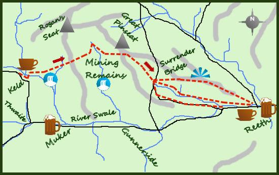
The Swale Trail takes a more lowland route, whilst this walk explores the upper areas of the dale with its industrial history. Take the bus from Reeth to Keld.
Keld is at the upper end of Swaledale and is a remote but lovely place. It marks the crossing of the Pennine Way and the Coast to Coast so whoever you see may be on one of these popular long distance trails.
From the bus drop in to the village and turn right along a lane high above the embryonic River Swale. After 200 metres turn left, steeply down hill, on a path leading to a bridge over the river. Climb up the other side until meeting a wide bridlepath and turn right.
The path contours the hillside and passes two waterfalls, the second is the impressive Kisdon Force. Soon after a switchback in the path a less obvious path leads you to Crackpot Hall, a derelict place of legend. It is an intriguing place which is safe to explore.
Continue along the path contouring the hillside as it bends in to the impressive Swinner Gill, a steep sided V-shaped valley. Follow this to a footbridge, turn left and enter a second side valley where the path climbs on to the open moors.
This is grouse shooting country, the butts on your left as you arrive at a wide Land Rover track.
The walk is now across wide open moors with far-reaching views all round. A track to your left (just after a gate) leads to the remote ‘Dales 30’ summit of Rogan’s Seat, a 45-minute detour (there and back) across the moors.
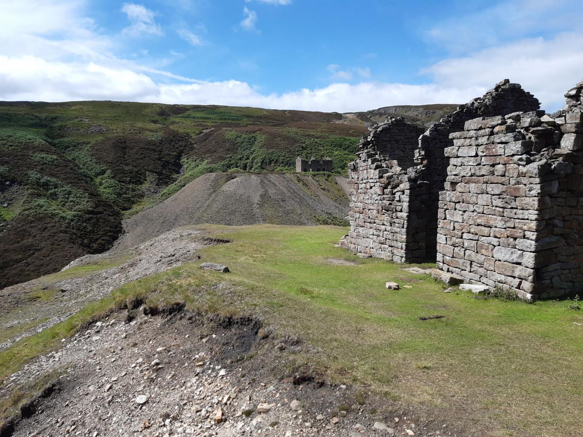
After a further third of a mile leave the obvious track and take the footpath to your left. Now you have to cross Gunnerside Gill, scene of some of the best remains of the thriving lead mining industry so important 150 years and more ago.
To cross the gill follow the path to a footbridge and after crossing take the path to your right. This path follows the river for quarter a mile before turning uphill and heading for a side valley. Climb the rough track through the valley before emerging in the industrial wasteland of old mine workings. It is a barren place but full of interest. The track (now wide and obvious) continues for one mile before dropping in to the valley of ‘Old Gang’.
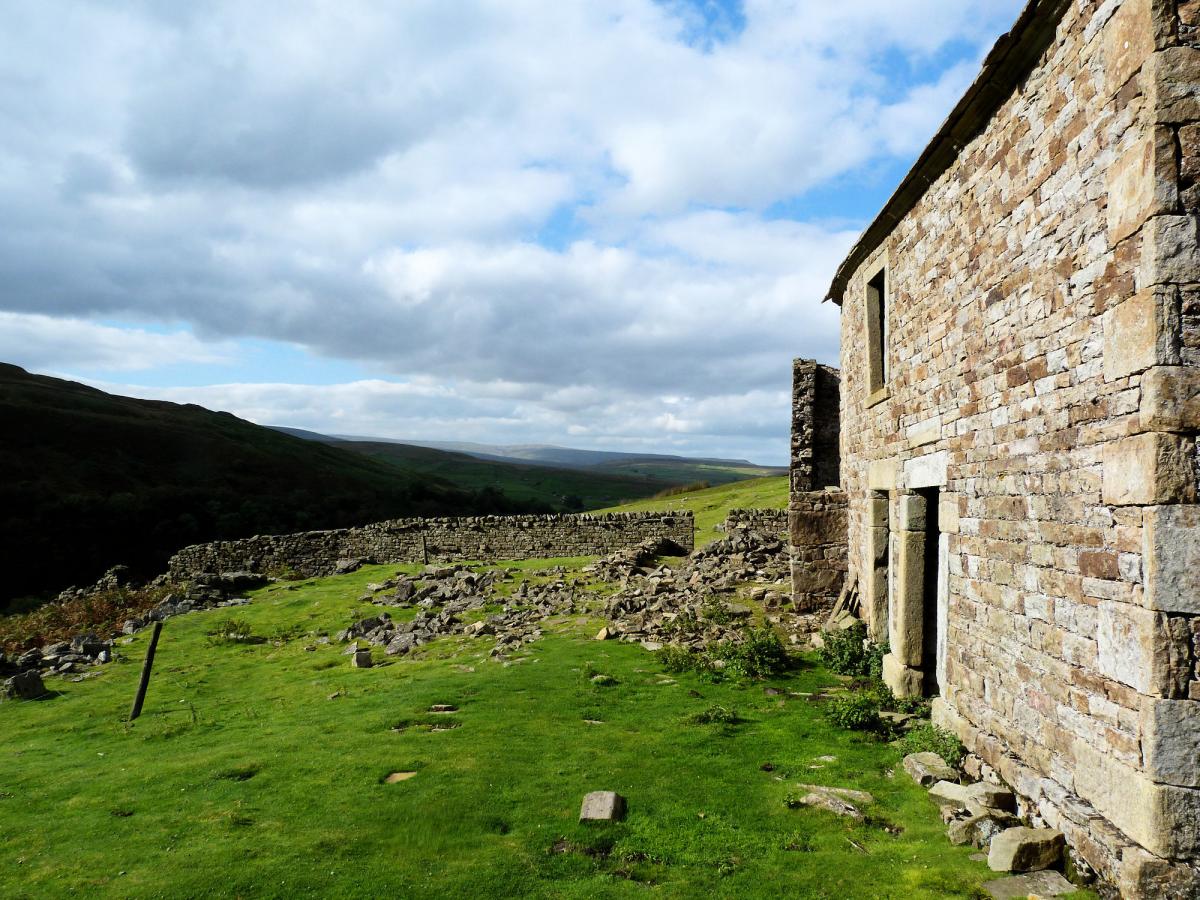
On reaching the river, Hard Gill, cross it and join another excellent track which you can follow alongside the river for over 1½ miles to a road. Enroute it is worth exploring the remains of the old smelting mill of Old Gang, an impressive place.
From the road at Surrender Bridge there is a choice of route back to Reeth, all three miles are downhill but some rougher than others.
There is a quiet road leading to Healaugh which is easiest but I prefer the riverside path alongside Barney Beck.
Alternatively there are a number of paths, crossing farmers fields, to the north of the river which can be followed along the hillside all the way back to Reeth.
I like the riverside path through the trees to Healaugh and then the final mile along the road to Reeth.
Fact box
Distance: Roughly 12 miles
Height to Climb: 390m (1,280 feet)
Start: Take the Little White Bus (no 30, not Sunday) at 9.22 from Reeth memorial. It takes just
over a half hour to Keld.
Remember to bring a mask for the journey.
Difficulty: Hard. Most of the tracks are however very good, often Land Rover tracks, making for some quick walking. There is a lot to see though to distract you.
Refreshments: Reeth has a number of good pubs and cafes.
Be Prepared: The route description and sketch map only provide a guide to the walk. You must take out and be able to read a map (O/S Explorer OL30) and in cloudy/misty conditions a compass. You must also wear the correct clothing and footwear for the outdoors. Whilst every effort is made to provide accurate information, walkers head out at their own risk.
Please observe the Countryside Code and park sensibly.


Comments: Our rules
We want our comments to be a lively and valuable part of our community - a place where readers can debate and engage with the most important local issues. The ability to comment on our stories is a privilege, not a right, however, and that privilege may be withdrawn if it is abused or misused.
Please report any comments that break our rules.
Read the rules here