
Jonathan Smith runs Where2walk, a walking company in the Yorkshire Dales. Jonathan has written his own book, the Dales 30 which details the highest mountains in the Dales. He also runs one-day navigation courses for beginners and intermediates. Join his Learn a Skill, Climb a Hill weekends in the Dales. To find out more details on any of the above visit his website, where2walk.co.uk
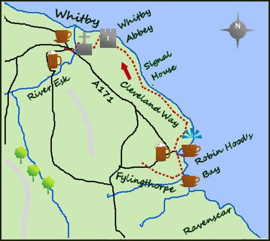
I ENJOY one way walks and there is no better place for these than the Yorkshire Coast. This short walk leaves plenty of time to explore Robin Hood’s Bay and Whitby, as well as the marvellous cliffs between them.
There is a regular bus service from Whitby to Robin Hood’s Bay. Stay on the bus at Robin Hood’s Bay and continue to the next stop at Fylingthorpe. Fyling Hall and the folly, known as The Pigsty, are a few hundred metres up the road (to the west). The return walk to Robin Hood’s Bay is also the last few hundred metres of the Coast to Coast long distance walk, and if you are lucky you may see some stragglers.
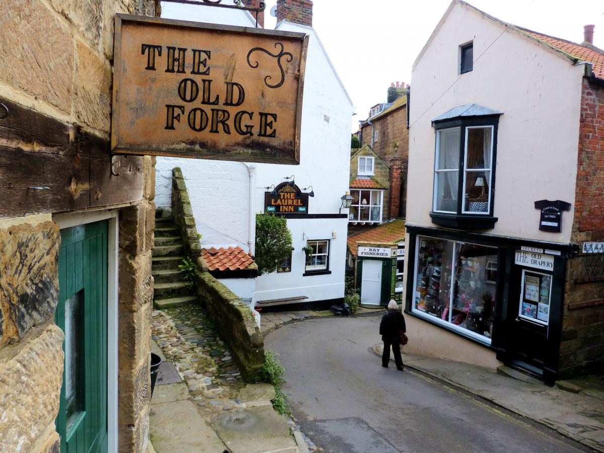
From the bus stop follow Middlewood Road south for 300 metres to a lane on your left, turning in to a footpath as it drops down to the Hay. Turn right before the sands and enter lower Robin Hood’s Bay as the smugglers did. It is worth spending some time wandering the through the tightly packed streets and even taking in one of the cafes before heading to the top of the village to start the main walk.
From the upper town of Robin Hood’s Bay, follow the coastline closely all the way to Whitby. The footpath starts just south of the old railway line and heads initially east towards a headland. After a few hundred metres look to your right at the lovely views across Robin Hood’s Bay and towards Ravenscar. The footpath follows the headland before dropping steeply (and climbing equally steeply) out from a stream which has cut into the cliffs. One mile further on, Oakham Beck creates an even steeper drop and climb. This is typical of coastal walking and the effort is worth the rewards of dramatic views and bracing air. The cliffs here are gradually eroding away and will eventually eat up the existing path.
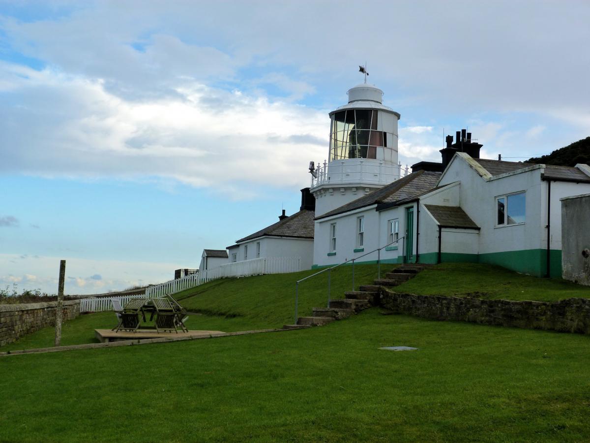
The path tracks the coast for a further two miles, past the old ‘Fog Signal’ before arriving at a large holiday park. Sadly the fog horn that used to blast out is now been de-commissioned, but there is still a splendid old harbour house (now private residency).
The holiday park is situated above a sandy beach (at low tide) which is worth visiting (if you have time). Having picked your way through the holiday park the imposing site of Whitby Abbey looms large ahead.
Whitby Abbey was (and still is) an impressive Benedictine Abbey which fell in to disrepair during the Dissolution of the Monasteries during Henry V111 reign.
The footpath keeps to the coast and passes on the coastal side of the abbey before cutting inland just before a TV satellite. The path joins Abbey Lane before arriving at St Mary’s Church, a building probably as old as the abbey itself. From here steps drop steeply to Whitby town and the fine harbour.
Fact box:
Distance: Roughly 6.5 miles
Height to Climb: 300m (985 feet).
Start: NZ 943050. Take the X93/94 (roughly every half hour, takes 15 minutes) from Whitby Bus/Train station. Drop off point for the bus in Fylingthorpe.
Difficulty: Easy/Medium: Some steep up and down on the coast but following a well worn path.
Refreshments: I would suggest a coffee in Robin Hood’s Bay near the start of the walk and fish and chips in Whitby.
Be Prepared: The route description and sketch map only provide a guide to the walk. You must take out and be able to read a map (O/S Explorer OL27) and in cloudy/misty conditions a compass (essential on this walk). You must also wear the correct clothing and footwear for the outdoors. Whilst every effort is made to provide accurate information, walkers head out at their own risk. Please observe the Countryside Code and park sensibly.


Comments: Our rules
We want our comments to be a lively and valuable part of our community - a place where readers can debate and engage with the most important local issues. The ability to comment on our stories is a privilege, not a right, however, and that privilege may be withdrawn if it is abused or misused.
Please report any comments that break our rules.
Read the rules here