
A DALES walk that has plenty of interest. The route can be muddy in places, with slippy rock and tree roots. There are a number of narrow stiles and gates.
THE most northerly of the dales, Swaledale and Arkengarthdale, have perhaps the wildest, most unspoilt scenery in the National Park.
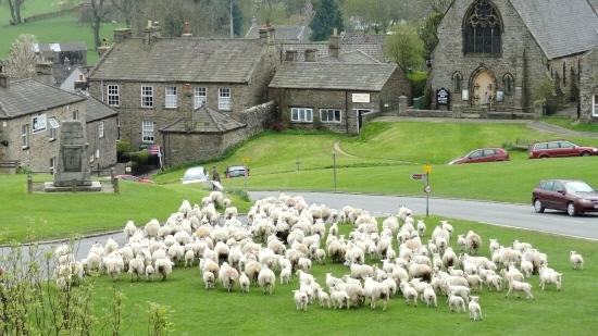
And it is where the two dales meet - in the bustling market town of Reeth - that we start our walk.
It enjoys a magnificent setting on a plateau above the River Swale, surrounded by a great panorama of hills, and its large sloping triangular village green adds extra character, flanked by art and craft shops, pubs and cafés.
In Saxon times, Reeth was only a settlement on the forest edge, but by the time of the Norman Conquest it had grown sufficiently in importance to be noted in the Doomsday Book. Today it is a thriving farming community.
The River Swale is one of the fastest rising flood rivers in England with a fearsome reputation for washing away bridges and unwary travellers in the past.
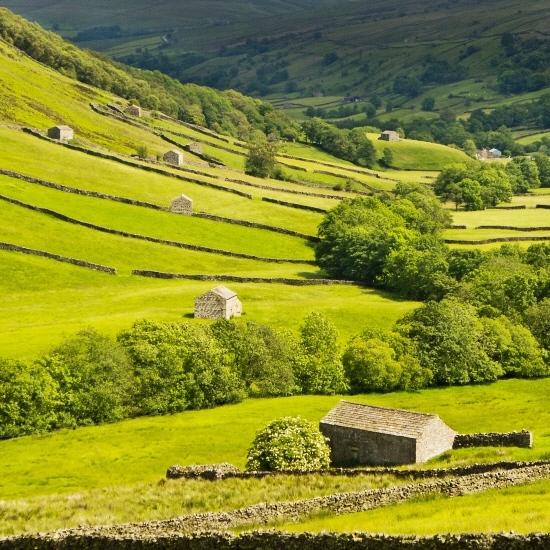
Today it flows through traditional haymeadows bright with wild flowers in the spring and dotted with carefully preserved stone field barns.
The peaceful heather covered hills above were once home to a thriving lead-mining industry. When the industry collapsed in the late 19th century, up to half the population of the dale left, some to the textile mills and coal mines of Lancashire, others to new lives in America.
The area is still famous for its breed of hardy sheep and associated knitting industry as well as locally-made cheeses.
Our walk also visits the village of Low Row, which is full of history. It has a 17th century stone inn, two churches and was apparently raided by Jacobites in 1745.
The walk has been provided by the Yorkshire Dales National Park Authority and for more walks, visit yorkshiredales.org.uk
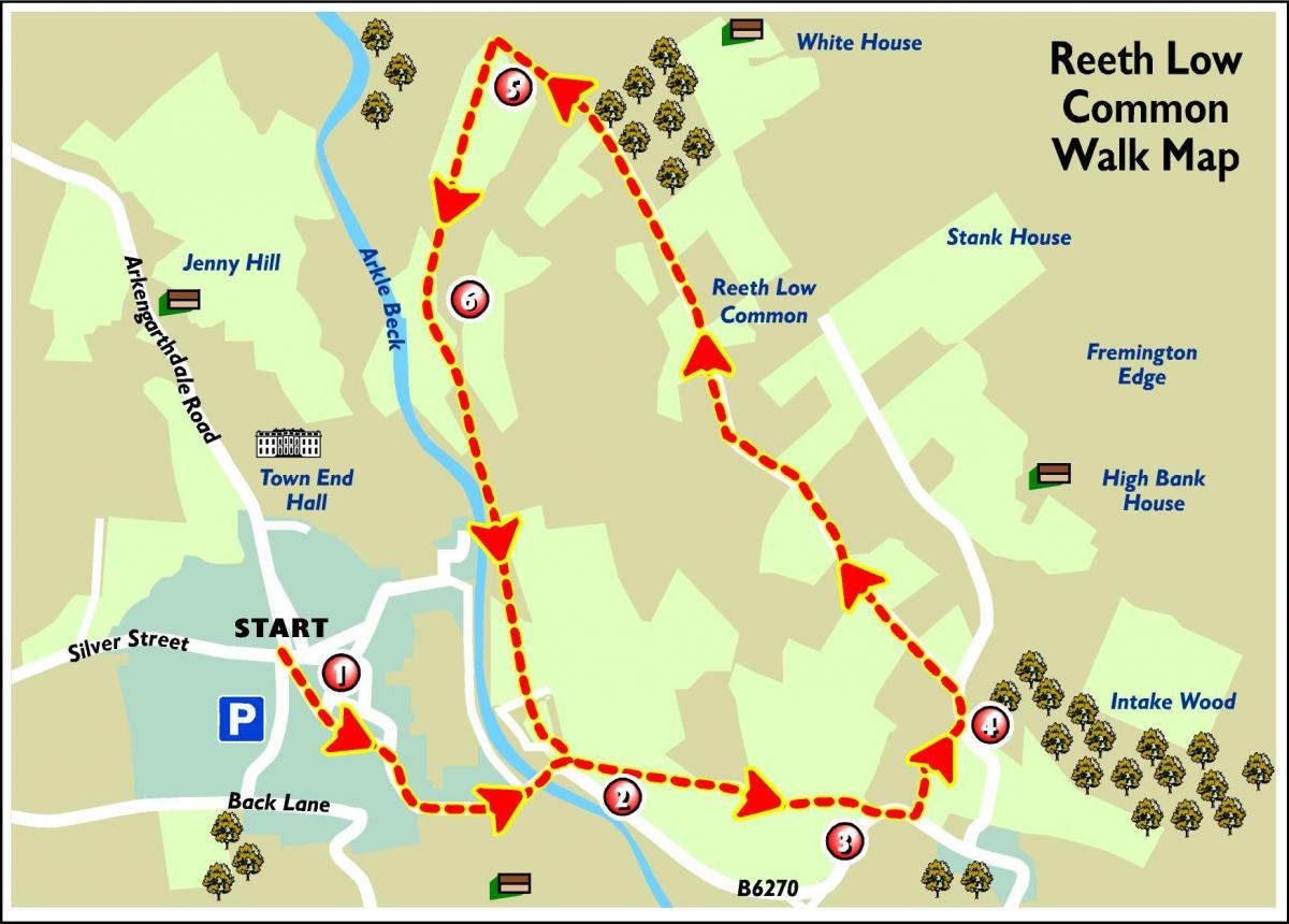
Step by step
1. Starting from the village green take the road down to Reeth Road Bridge, crossing with care.
2. Then take a footpath on your left across open fields towards High Fremington.
3. Bear left up a tarmac road for a short distance before turning left up by the first house you reach, onto a steep unmarked rocky walled lane.
4. Turn left at the top and take the bridleway signed to Arkengarthdale 4. Follow this pleasant grassy lane for approximately 800 metres (0.5 miles). Fine views here of Reeth and the patchwork of stone walls and field barns which make Swaledale famous. The moorland tops display carpets of purple heather in August time; a wonderful sight. Along this path traces can be seen of an old stone paved way; this dates back to the lead mining era and was used by miners on their way to and from work. After a while pass through a fieldgate onto the open common and continue ahead to a wallside where four routes join.
5. Take the left hand footpath through the narrow stone stile and head down towards the field barn along the obvious well-trodden path.
6. Continue ahead on the footpath through a series of narrow stiles and gates, crossing valley bottom meadows. To the left Fremington Edge towers above you. Traces of the old quarry workings can be seen from here. Upon reaching Reeth Bridge, bear right along the road and retrace your steps back to the village green.
Fact file
Distance: 4km (2.5 miles)
Time: a minimum of 1 hour
Parking: Reeth Village Centre on the cobbles
Other transport:
• bus 30 from Richmond
Toilets: Reeth
Refreshments: shops, pubs and cafés in Reeth


Comments: Our rules
We want our comments to be a lively and valuable part of our community - a place where readers can debate and engage with the most important local issues. The ability to comment on our stories is a privilege, not a right, however, and that privilege may be withdrawn if it is abused or misused.
Please report any comments that break our rules.
Read the rules here