

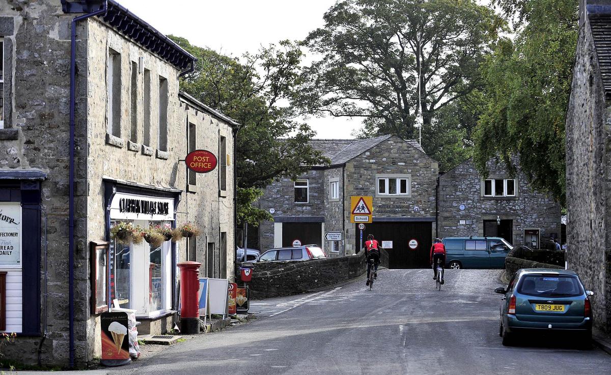
IT may well have escaped most people's notice, but Clapham bypass just passed a significant milestone - its 50th birthday.
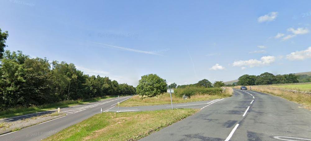
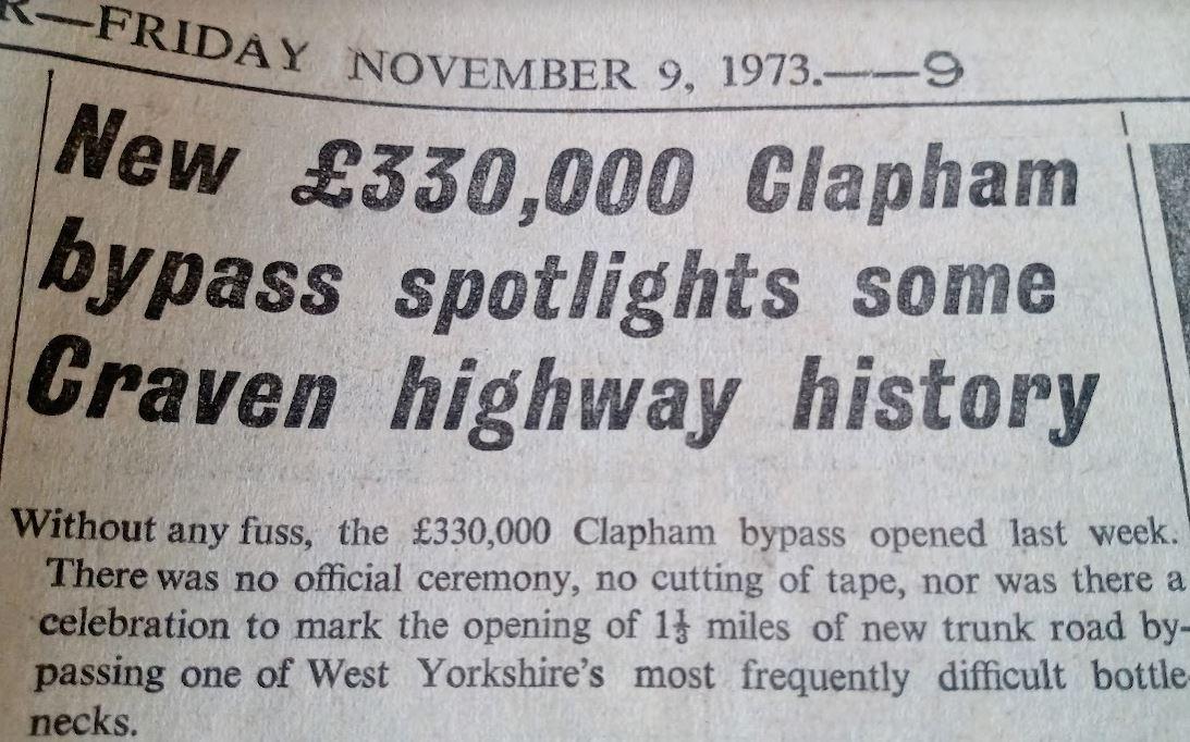
It was in the first week of November, 1973 that the new £330,000 section of road - now part of the A65 - was opened, with apparently, very little fuss.
One wonders if the same low key treatment will mark the opening, in the autumn of 2025, if all goes to plan, of the new £68.8m three mile stretch of the A59 at Kex Gill - probably not.
Back 50 years ago, the Craven Herald reported that the opening of the new road at Clapham, work on which had only begun in December, 1972, was carried out without any official ceremony, or cutting of tape.
"There was no celebration to mark the opening of the 1.3 miles of new trunk road bypassing one of the district's most frequently difficult bottle-necks," reported the Herald on November 9, 1973.
It continued: "The Clapham bypass is the latest, and not the last attempt at streamlining a route through the Pennines used commercially at least as long ago as Roman times. Packhorses and rickety carts were forerunners of today's rumbling juggernauts."
The Herald then went on to give a history of the route, its importance and its development over the years.
Using Ogilby's Britannia, first published in 1675, it said that the Keighley-Kendal road was defined as being part of two main routes.
From Keighley to Skipton, it appeared under the 'London to Richmond' section, which ran by Kettlewell and Middleham; while from Skipton to Clapham, the road was part of the 'York to Lancaster' route.
Surveying the road for his map of Yorkshire in the 1720s, John Warburton referred in detail to the route. For example, he noted that travellers crossed Eastburn Beck by an old stone bridge.
From the maps of Warburton and Ogilby, it was seen that the road left Skipton at the church, crossed by Mill Bridge and ascended The Raikes. It followed the existing line of the White Hills lane and descended by 'Sterton and Thaulby' to the line of Gargrave Road. Beyond Coniston Cold, the old road could be seen as a green track running across the Coniston Hotel estate towards a depression called 'Sweet Gap, or Scot's Gap.
In Whitaker's History of Craven 'Scot's Gap' was the traditional site of the defeat of the men of Craven by a band of raiding Scots after Bannockburn. In Whitaker's book, the track then joined the road at Switcher's Farm, where coach horses were changed.
From South to North, there were toll bars at Steeton, Snaygill, Gargrave, or Holme Bridge, Coniston, Long Preston, Settle Bridge, Clapham and Ingleton.
Under the county authority, said the Herald, the Keighley- Kendal road had seen an increase in heavy traffic and 'considerable criticism' . Of the local authorities concerned with the condition of the road, Settle Rural Council had become very preoccupied.
The Herald reported: "Despite complaints to their MP, passed onto Ministry level, Whitehall gave the council the brush off on the road, which councillors maintained was vital for the livelihood of the area.
"The trunk road could not be assessed as high priority within the framework of regional and national needs, the council was informed by the Department of the Environment. The department were however keenly aware of the condition of the road and would remain sympathetic to proposals for improvement whenever possible."
Recent improvements had at the time taken place on the three mile stretch between Cononley Lane End and the outskirts of Skipton. Gargrave's main street had undergone reconstruction. At Settle Junction, the road had been improved, and at Settle, the trunk road between Ingfield Bridge and The Falcon Hotel was 'nearing completion'.
Meanwhile, the reconstruction of Church Street, Settle, and the provision of a crawler lane for slow moving traffic up Buckhaw Brow were 'in the pipeline'.
At Harden Bridge, reconstruction had done away with the notorious 'dog-leg' bridge. Three miles to the West of Clapham, the removal of Skew Bridge removed another notorious corner along the A65, and north of Ingleton, beyond Bradford House, the removal of a disused railway bridge concluded the list of then recent improvements to the road.
Until April, 1974, the 33 miles of the Keighley to Kendal 'turnpike' were the responsibility of the West Riding County Council. After then. from the Lancashire boundary beyond, North Yorkshire County Council became responsible for the trunk road as far as Kildwick; the remainder under West Yorkshire.
The Herald reported: "To the motorist who queues for long periods outside Skipton, it must seem like planning in reverse, to increase the pressure on such bottle necks by building and reconstructing faster roads, when there are more apparent needs for bypasses. Just ask the people of Clapham."


Comments: Our rules
We want our comments to be a lively and valuable part of our community - a place where readers can debate and engage with the most important local issues. The ability to comment on our stories is a privilege, not a right, however, and that privilege may be withdrawn if it is abused or misused.
Please report any comments that break our rules.
Read the rules hereLast Updated:
Report this comment Cancel